By Mike Busch
From the National Weather Service:
…HIGH SURF AND DANGEROUS RIP CURRENTS EXPECTED ALONG THE
ATLANTIC OCEAN BEACHFRONT THIS AFTERNOON THROUGH SATURDAY…
…MINOR TO LOCALLY MODERATE COASTAL IMPACTS TODAY INTO
SATURDAY…
…HIGH RIP CURRENT RISK REMAINS IN EFFECT THROUGH SATURDAY
EVENING…
…COASTAL FLOOD ADVISORY REMAINS IN EFFECT FROM 1 PM THIS
AFTERNOON TO 9 PM EDT SATURDAY…
…HIGH SURF ADVISORY REMAINS IN EFFECT FROM 2 PM THIS AFTERNOON
TO 9 PM EDT SATURDAY…
* LOCATIONS…Vulnerable coastal locales along Southwestern
Suffolk, Southeastern Suffolk, Southern Queens and Southern
Nassau, including the Atlanic ocean beachfront and twin forks of
Long Island.
* TIMING…For the High Surf Advisory, from 2 PM today to 9 PM
EDT Saturday. For the High Rip Current Risk, through Saturday
evening. For the Coastal Flood Advisory, minor to locally
moderate during the times of high tide from 1 PM today to 9 PM
EDT Saturday.
* COASTAL FLOOD IMPACTS…Shallow flooding is expected in the
most vulnerable locations near the waterfront and shoreline.
Expect around 1 to 2 feet of inundation above ground level in
low lying, vulnerable areas. Some roads and low lying property
including parking lots, parks, lawns and homes/businesses with
basements near the waterfront will experience shallow flooding.
* SHORELINE IMPACTS FRIDAY THROUGH SATURDAY…High surf will
develop Friday Afternoon into Friday Evening, peaking at 6 to
10 kt for the ocean beaches of NYC and Western Long Island,
and 8 to 12 feet across Eastern Long Island beaches Friday
Night into Saturday Morning, before gradually subsiding
Saturday afternoon. These large breaking waves will result in
significant beach flooding and erosion. Areas of erosion to
dune structures and localized washovers are also possible
during the times of high tide, resulting in some flooding of
roadways and vulnerable structures behind low-lying protective
dunes. Finally, very dangerous rip currents are expected
during this time, posing a danger to anyone who enters the
surf.
PRECAUTIONARY/PREPAREDNESS ACTIONS…
A High Surf Advisory means that high surf will affect beaches in
the advisory area, producing rip currents and localized beach
erosion.
A Coastal Flood Advisory indicates that onshore winds and tides
will combine to generate flooding of low areas along the shore.
Rip currents are powerful channels of water flowing quickly away
from shore, which occur most often at low spots or breaks in
sandbars and near structures such as groins, jetties, and piers.
Talk to lifeguards and beach officials to learn about any surf
hazards and heed their advice. Pay attention to flags and posted
signs and swim in life guarded areas.
Swim near a lifeguard. If caught in a rip current, relax and
float, and do not swim against the current. If able, swim in a
direction following the shoreline. If unable to escape, face the
shore and call or wave for help.
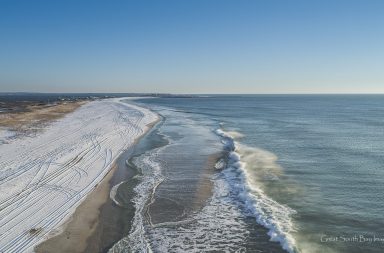
You can watch the surf come up live on the two new cameras stationed on top of the Davis Park Casino below or on the tabs on top of the website. As you can see on the surf cam, there is a big dune restoration project underway now, it will be interesting to see if they have to move the equipment back if the tide comes up.


