By Marshall Brown
The Great South Bay has over 30 creeks flowing into it. We have mapped nearly every one, and now they are public maps.
Here is the one linked to Carll’s River.
We are doing this because we want to give every community the ability to map itself. This platform, from Loveland Technologies, has 135 million parcels in its database, nationally. It contains all the parcel / lot data for Nassau and Suffolk County. The platform is complemented by Site Control, which gives people the power to run surveys and generate reports. Let’s say you have a map of all the properties adjoining a creek. And local residents could append pictures and notes about the condition of the creek as it runs by their property. Imagine groups being able to take water, air, or soil test data, and pin it right at the point it was measured? What if you could do this over time so as to note trends? What if every environmental and civic group and every local, state, and federal agency all had their data on this one platform?
Field workers, volunteers or paid surveyors or interns, would survey the area using the Loveland mobile app.
That is the vision: Local stewardship, collaboration, citizen science, transparency.
Save The Great South Bay now has over 10,000 members in their Facebook Group. Every South Shore community is well represented.
Here are the creeks we’ve mapped so far:
- Narraskatuck Creek
- Amityville Creek
- Wood’s Creek
- Howell’s Creek
- Great Neck Creek
- Strong’s Creek
- Little Neck Creek
- Negungtatogue Creek
- Santapogue Creek
- Mud Creek
- Carll’s River
- Sumpawams Creek
- Willet’s Creek
- True’s Creek
- Thompson’s Creek
- Brightwaters Channel
- Penataquit Creek
- Orowoc Creek
- Champlin’s Creek
- Connetquot River (Lower)
- Indian Creek
- Greene’s Creek
- Mill Pond Stream
- Brown’s River
- Patchogue River
- Tuthills Creek
- Swan River
- Mud Creek (Patchogue)
- Beaver Dam Creek
- Carman’s River
- Corey Creek
Wish to help out on a particular creek? Join our Facebook Group, and there will be dozens more from your community you can join forces with. Our view is this — the health of the bay depends on the health of the creeks that feed it, that that depends on every community stepping up and protecting what is right in their own backyards.
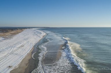
Beyond Maps, we plan on using technology including drone images and photography to give a bird’s eye view of these creeks and their relationship to the Bay.
To that end, Save the Great South Bay Directors Mike Busch and Todd Shaw recently took an aerial tour of Carll’s River from Sunrise Highway down to the Bay including Southard’s Pond and Argyle Lake that will be released tomorrow.
For more about Save The Great South Bay click here.


